The Pila – Mujong FMU covers a total area of 100,978 Ha out of the total licensed area of 115,698 Ha, constituting partial Batang Baleh – Batang Rajang Stateland Forest which falls inside the watershed of Sg. Mujong – Batang Baleh and Sg. Pila – Batang Rajang area. The proposed FMU area is located within Bukit – Raya Forest Felling Plan and divided into 25 coupes. The forest is still undergoing re-entry hill logging in the Song Logging Company Sdn. Bhd., T/0518.
The Locality Map of the Proposed Pila – Mujong FMU:
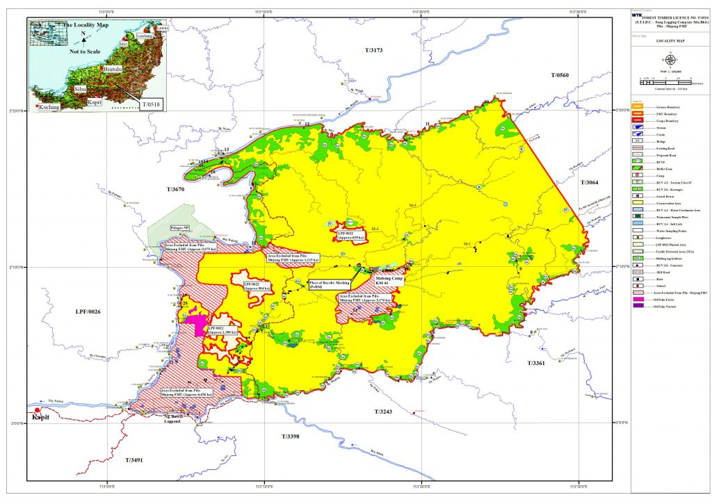
The FMU can be reached by road from Sibu Town, which is about 69 km upstream from Kapit Town.
The altitudes of Pila – Mujong FMU is ranging from 250 m in the Northern part at the lower hill areas to 1,758 m at highest spot at the Mid-center tip above sea level next to Sut Sawmill (3064) Sdn. Bhd. timber licensed area – Ulu Sg. Mujong, Batang Baleh and Sg. Pila, Batang Rajang Sarawak.
The FMU is mainly covers by Terrain Classes I, II and III, only few areas have steep dissected terrain with slope greater than 35o or Terrain Class IV which is too steep for conventional bulldozers based logging. The region has a tropical type of climate affected by the monsoon seasons, which is generally hot, wet and humid throughout the year.
There were 127 longhouses/settlements or local communities within Forest Timber Licence (FTL) No. T/0518. Amongst them, there were 44 longhouses/settlements found outside the FMU boundary and 83 longhouses/settlements were found within the Pila – Mujong FMU (i.e. within 3 km radius in straight line/water way and are as identified-affected communities (IAC)).